


la Chapelle des Pots ( D ROUSSET)

Claudinette17
Utilisateur
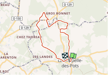

Longueur
7,8 km
Boucle
Oui
Date de création :
2024-01-29 12:43:27.663
Dernière modification :
2024-01-29 15:24:53.921
2h40
Difficulté : Moyen

Application GPS de randonnée GRATUITE
 SityTrail
IGN / Instituts géographiques
SityTrail Plus
Le monde est à vous
À propos
Randonnée Marche de 7,8 km à découvrir à Nouvelle-Aquitaine, Charente-Maritime, La Chapelle-des-Pots. Cette randonnée est proposée par Claudinette17.
Localisation
Pays :
France
Région :
Nouvelle-Aquitaine
Département/Province :
Charente-Maritime
Commune :
La Chapelle-des-Pots
Localité :
Unknown
Départ:(Dec)
Départ:(UTM)
691162 ; 5070292 (30T) N.
Commentaires